Search

Which No Trespassing Signs Are Better? Plastic of Paper (Tyvek)?

  • Thread starter JGaulard
  • Start date
JGaulard

JGaulard

Administrator
Staff member
Site Supporter
Sr. Site Supporter
Power User
Joined
May 5, 2021
Messages
319
Reaction Score
2
Points
18
  • #1
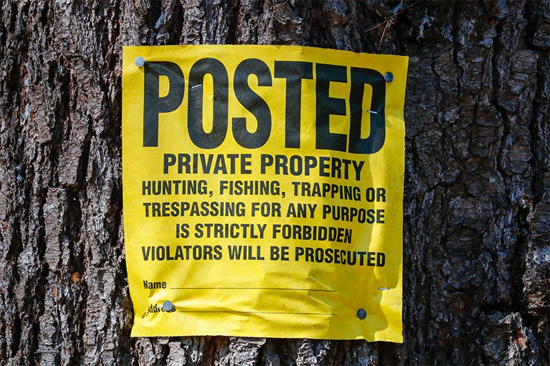
Have you ever wondered which private property, no hunting, no trespassing signs are the best and longest lasting? I have. I used to think it was the plastic ones, but my mind has been changed now that I've had a chance to see how they hold up outdoors over time. There are a few types you can choose from; plastic, paper or Tyvek, aluminum, wood, you name it. Most of the time, we'll buy the signs from Amazon or Tractor Supply or something like that. Two years ago, I bought ten plastic signs and a roll of 100 paper ones from Tractor Supply. I think the plastic ones were about $1 each and the paper ones were $10 for a roll of 100. These signs range in price greatly. Right now, I'm on Amazon checking out some prices. I see a pack of 25 plastic signs selling for around $10. I see a roll of 100 Tyvek signs for around $25. I see a four-pack of aluminum signs for $15. There's no rhyme or reason for all of these random prices. All I know is that I got a decent deal.

Tomorrow I'll be out in the woods stapling my posted signs back to the trees I attached them to two years ago. The trees have grown, so the signs are getting stretched and some are popping off. I've been watching how they handle the weather and which ones last the longest and I'm happy to report that the Tyvek signs are so much better than the rigid plastic ones. Those plastic signs are cracking and fading in the sun, while the paper signs are still bright yellow and in perfect condition. I'm very surprised by this. So tomorrow, I'll bring my camera with me to grab some photos of what the current situation is. Hopefully, this will help you out if you're interested in posting your own property.
 
JGaulard

JGaulard

Administrator
Staff member
Site Supporter
Sr. Site Supporter
Power User
Joined
May 5, 2021
Messages
319
Reaction Score
2
Points
18
  • #2
Okay, I've got some photos for you. I took these pictures this morning. These signs are all the same age. I bought them and nailed them to the trees the same day. You be the judge of which has better stood the test of time.

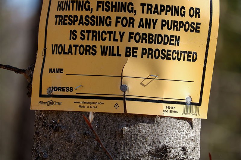
First, we've got the hard plastic sign. I nailed a bunch of these to the trees around my property and they're all in the same lousy condition. I'll never buy these again. Also, don't mind the half-stapled staples. I was on my tippy-toes this morning trying to get them in and it didn't work very well.

cracked-plastic-no-trespassing-sign.jpg cracked-posted-sign.jpg old-posted-sign.jpg

Lots of cracks. Also, as the tree grows, the sign pops off the nails. Not good.

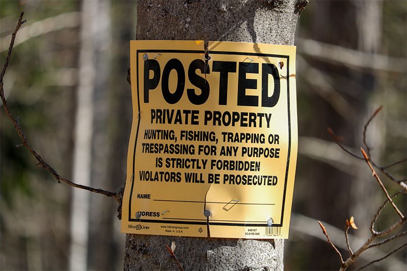
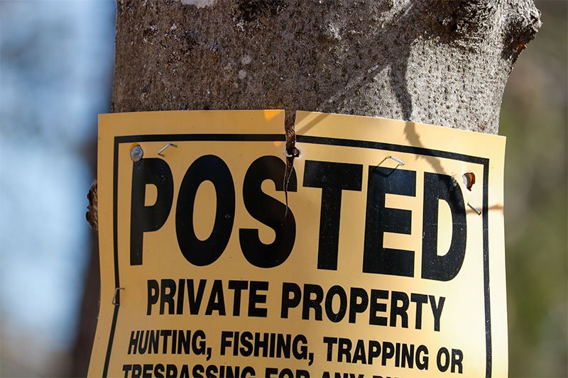
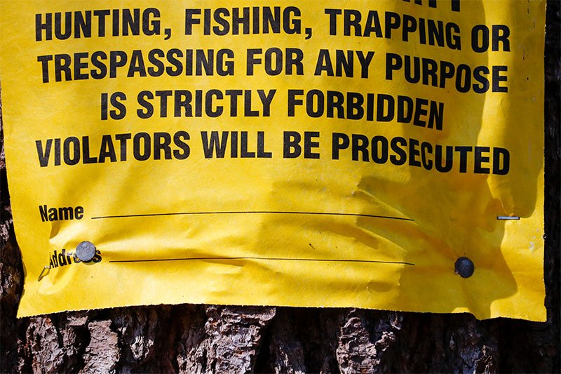
Here is a Tyvek sign. Every one of these is still perfect. The color is vibrant and as the tree grows, the sign merely gets tighter, but doesn't pop off the nails. I'll simply go around and throw a few staples in the sign every few years to keep it attached to the tree. As you can see, I did a better job stapling this one.

tyvek-no-trespassing-sign.jpg tyvek-paper-posted-sign.jpg
 
JGaulard

JGaulard

Administrator
Staff member
Site Supporter
Sr. Site Supporter
Power User
Joined
May 5, 2021
Messages
319
Reaction Score
2
Points
18
  • #3

Eroding Property Lines​

I bought some land a few years ago that's adjacent to the land I already owned. It's a fairly simple plot to find the borders of. The thing is, one side of the piece of property borders a brook and through the years, one small portion of that boundary has fallen into the brook. Part of the property line is identified by a stone wall and while that stone wall does traverse the landscape just fine for approximately three acres, approximately 100 or so feet has disappeared. Through the years, there have been massive rain storms that have caused flooding that has eroded the banks of the brook and have widened the brook itself. With this last storm and flooding that we experienced (Christmas 2020), I decided to head outside with my camera to take some photos and video of what remains of that portion of the border. It's not easy filming what's not there anymore, but I think I've identified enough clues to piece the picture together.

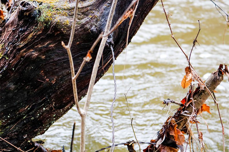
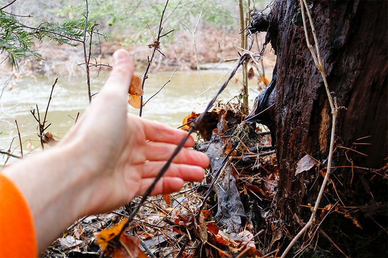
Okay, think of it this way. The east edge of this new piece of property runs north/south along a brook. The deed says to follow the brook north from a point, until you hit a stone wall, which is about 200 feet from the point, plus or minus. When you measure 200 feet from the point identified on the deed, there's no rock wall. There's an easily identifiable stone wall across the brook at about that distance, but none on my side. And the one that's on the other side runs straight into the brook, perpendicularly. I believe the stone wall on my side used to be there, running parallel to the brook, but has fallen into the brook because of the erosion. Why do I think this? Because the stone wall does actually exist, but it begins about 100 feet further north. Along that more northern portion of stone wall, there's old barbed wire that's attached to old dead cherry trees. As I follow the brook north from that 200 foot mark, I have discovered an old cherry tree about 20 feet from the 200 foot mark that's got barbed wire embedded into the tree. Also, there are stones that have fallen into the brook all along those 100 feet.

In this post, I'll show some photos that I've recently taken as well as some video. I wanted to do this to capture the current state of things as to avoid any discrepancies in the future. Although the stone wall is a clear property border monument, one can never be too careful. I want to get this barbed wire and the cherry trees documented before they completely fall into the brook. As you'll see in the photos and video down below, that may happen sooner rather than later.

Do you have a piece of property with an eroding boundary? What have you done about that? I can imagine this sort of thing happening quite a bit. The only action I can think of taking is to either get the land surveyed professionally or to document the existing border as best I can. Let me know if you've got any advice. I'm in Maine.

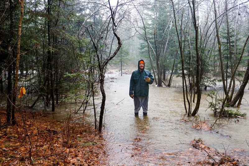
This is what got me thinking. This is me standing out near the brook yesterday on Christmas day 2020. The brook is all the way in the back. It's only about 20 feet wide. Well, with all the flooding we've been getting, you can see how wide it's become.

flooded-brook.jpg

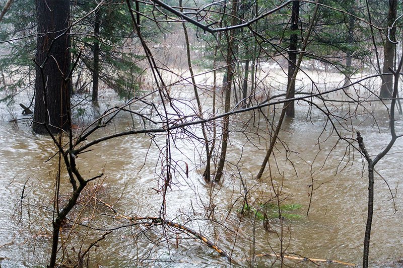
Here's another shot a bit farther downstream. You can see the brook running horizontally in the back. It's slightly lighter looking than the rest of the water. I would say the water that made it onto land was about two feet deep.

flooded-brook-maine.jpg

This is a great example of how wide the brook has become. Look at how far this ash tree is jutting out. That was once growing on solid land and now it's stranded out on a peninsula.

eroded-brook.jpg

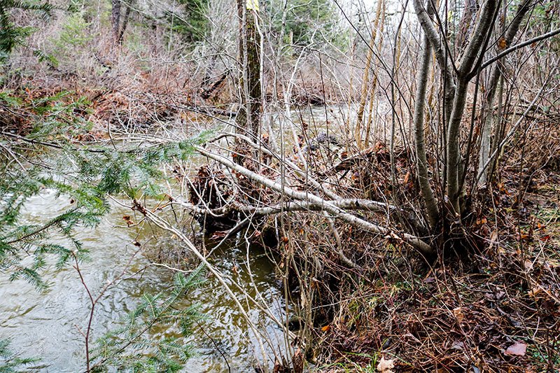
Much of the border of this side of the property was once lined by living cherry trees. Most of these trees are dead now, but remain standing. One this portion of lost rock wall, I've located some old barbed wire that's embedded in one of the cherry trees. You can see how the tree is leaning out into the brook due to erosion.

old-barbed-wire-cherry-tree.jpg

And if you follow the brook up to the point at which the stone wall now begins, you'll find more of that strange of barbed wire.

old-barbed-wire.jpg

You can also see how that's embedded into another cherry tree.

While I recognize that these photos don't show much, I took some video that does. I'll post that below. Also, I'll be heading out tomorrow to take some more video of the entire eastern edge of both properties, just to make things ultra clear.


Here's a video I took yesterday of the flooding:


I was also just watching the video I took this morning again and I'm beginning to wonder if some of the wall has not only fallen into the brook, but some of it has actually been covered with silt from the storms. It appears that the wall is still intact on the corner. It's just lower than the rest. I wonder if the person who built it, did so during the summer when the water was at its lowest point. Then, through the years, flooding pushed sand and dirt over that part of it.
 
JGaulard

JGaulard

Administrator
Staff member
Site Supporter
Sr. Site Supporter
Power User
Joined
May 5, 2021
Messages
319
Reaction Score
2
Points
18
  • #4
I took some more video yesterday, so I think my job is done here. I merely wanted to document what this section of property boundary looks like today as to avoid any confusion in the future if the banks of the brook continue to erode. Here's the video.

 
JGaulard

JGaulard

Administrator
Staff member
Site Supporter
Sr. Site Supporter
Power User
Joined
May 5, 2021
Messages
319
Reaction Score
2
Points
18
  • #5

Mysterious Lines on Large Stone in Stream Bed​

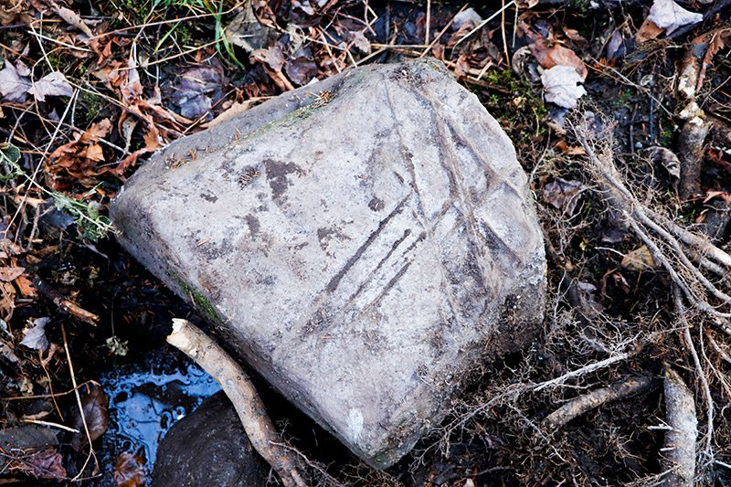
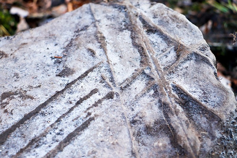
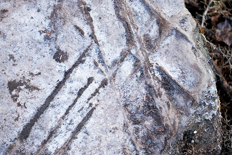
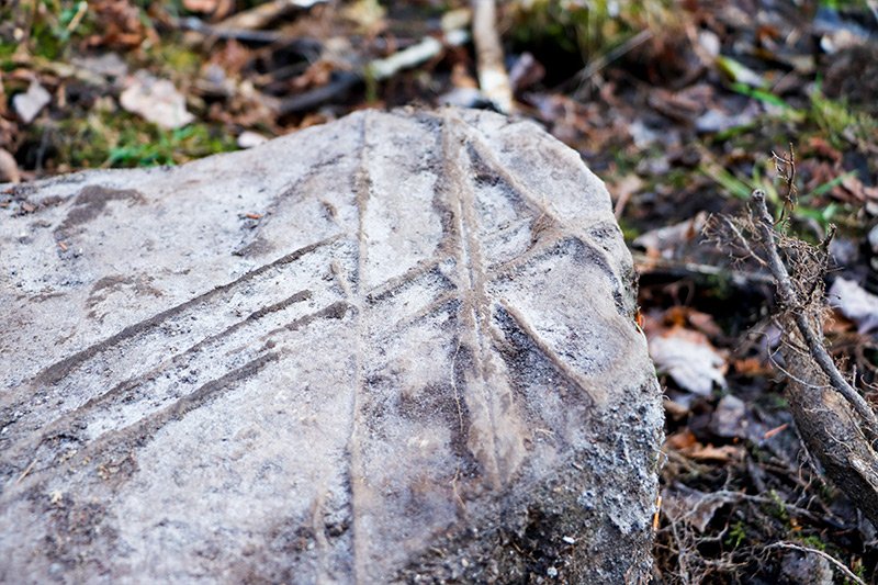
I have a question for the world. I'd really like to know what is going on. I was outside yesterday digging in a stream bed back in my woods when I turned over a semi-large stone to find some odd lines on it. The rock was at the surface, but it was covered with moss. The lines were facing down. If I had to guess, I'd say the stone weighs around 60-80 pounds, although I really have no idea. It measures about 16 inches across and about 12 inches deep. I really don't think these lines are made by nature, so I don't think this is some sort of fossil, but I can't imagine why anyone would carve a rock like this. Could it be a large fossil? Of could someone from long ago have somehow carved this rock? Take a look at the lines. They're very straight and the angles are precise. This can't be made by nature.

If you have any idea of what this is or how it got to be this way, please let me know.

large-fossil-rock.jpg large-stone-lines-streambed.jpg mysterious-lines-on-rock.jpg strange-lines-on-rock-riverbed.jpg
 
Top